Comparing Elements to be Added or Modified for GIS Exchanges
Any referenced datasets can be downloaded from "Module downloads" in the module overview.
Step-by-step:
When you use the GIS Gateway to create new features or update changes to existing features, you can compare and identify what model elements will be added or modified when the GIS exchanges are completed.
- Open the appropriate .aprx file in ArcGIS Pro.
- From the ribbon, InfoWater Pro tab, Project panel, click Initialize.
To help see the differences more clearly in the comparison, hide the Junctions layer and temporarily un-map the PIPEHYD->LENGTH field:
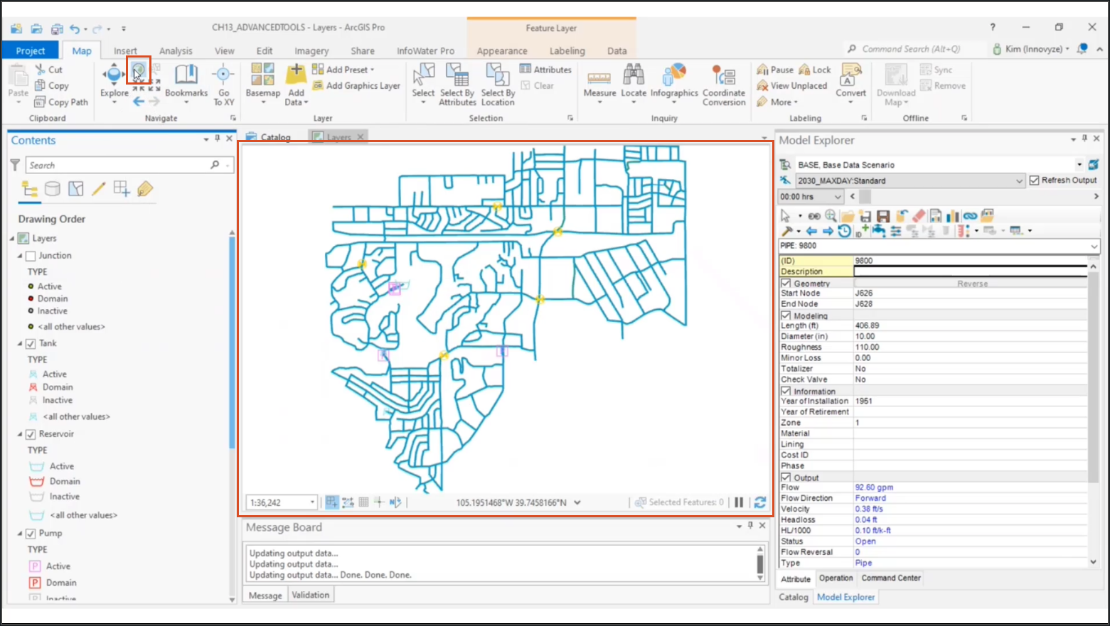
- In the ArcGIS Contents panel, deselect the Junctions layer to better view the pipe layer.

- In the ArcGIS Pro ribbon, Map tab, Navigate panel, click Full Extent to zoom the map view to the full extent of the model.

- On the ribbon, InfoWater Pro tab, Edit panel, click GIS Gateway.
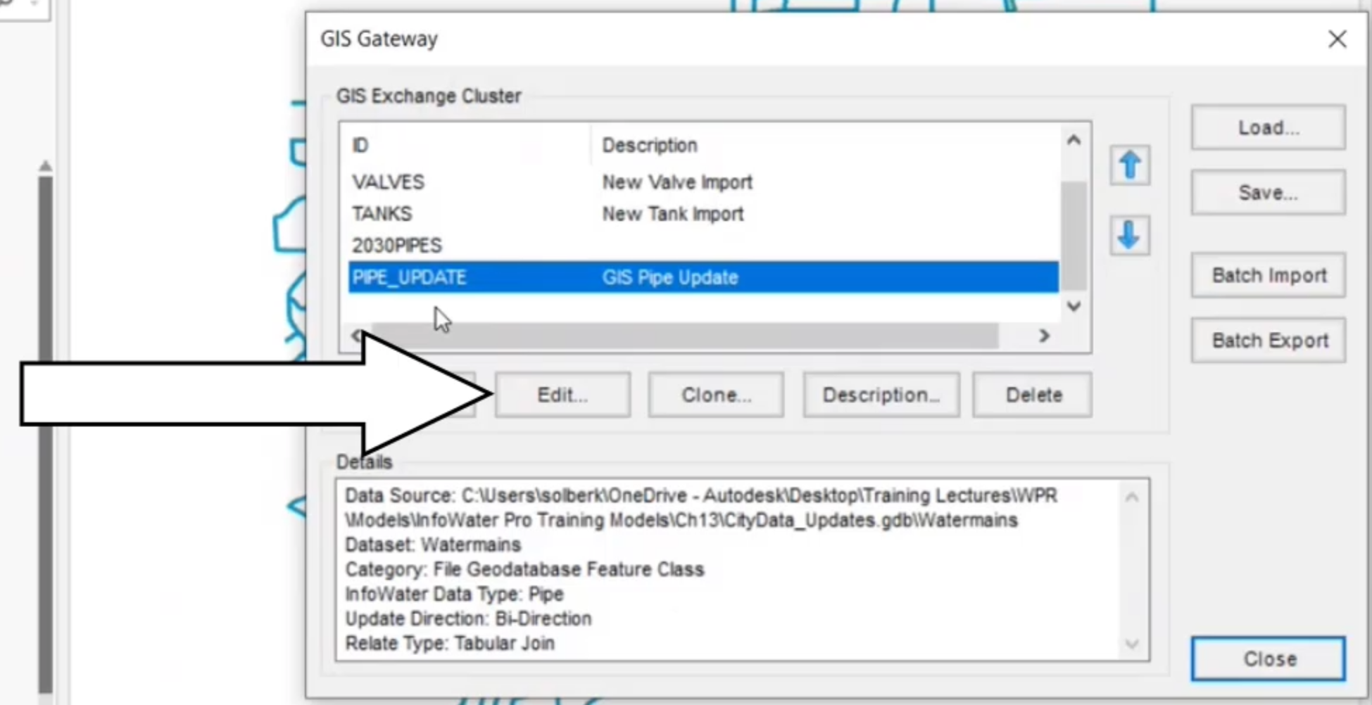
- In the GIS Gateway dialog box, GIS Exchange Cluster group, select PIPE_UPDATE.
- Click Edit.

- In the GIS Exchange Cluster dialog box, from the Field Mapping tab, Networks/GIS Data Field Mapping list, select PIPEHYD->LENGTH.
- Click Remove (<).

Note: You are temporarily un-mapping this field for the sake of comparison; otherwise, all the pipes in the model will show as having a different length.
- Click OK to save the changes.
- Drag the GIS Gateway dialog box to better view the map of the entire pipe network.
- Click Load.

- Drag the Load Data from GIS Layer or Table dialog box to the side.
- Select PIPES, New Pipe Import.
- Click Compare.
- In the GIS Data Difference dialog box, review the list of new pipes to be added.

- Close the GIS Data Difference dialog box.
- In the Load Data from GIS Layer or Table dialog box, select PIPE_UPDATE, GIS Pipe Update.
- Click Compare.
- In the GIS Data Difference dialog box, review the list of pipe updates that displays.

This comparison table identifies field changes that this exchange cluster will make. The fields highlighted in red represent those that are different between the two sources. For example, you can see that several pipes have been upsized to 12 inches.
Use the table to identify differences between the GIS and model to determine which elements and fields will be updated when the exchange is run.
- Close the GIS Data Difference dialog box.
- Close the Load Data from GIS Layer or Table dialog box.
To re-map the pipe length field:
- In the GIS Gateway dialog box, GIS Exchange Cluster section, select PIPE_UPDATE.
- Click Edit.
- On the Field Mapping tab, click Auto Map (>>).
- Click OK to save the changes.
- Click Close to exit the GIS Gateway.